
About Course
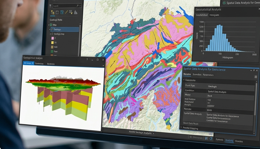
This course provides a practical introduction to the use of ArcGIS for geoscience applications, focusing on spatial data management, analysis, and map production. Participants will learn how Geographic Information Systems (GIS) are used to collect, organize, visualize, and interpret spatial information for geological, environmental, hydrological, and natural resource studies.
The course covers the fundamentals of ArcGIS, including data acquisition, coordinate systems and projections, georeferencing, digitization, database management, and cartographic design. Learners will explore various spatial analysis techniques such as overlay analysis, buffering, terrain analysis, interpolation, suitability mapping, and spatial modeling. Special emphasis is placed on applying GIS tools to geological mapping, mineral exploration, groundwater assessment, environmental monitoring, and land-use planning.
Through hands-on exercises and real-world case studies, participants will develop the ability to create professional maps, manage geospatial datasets, perform spatial analyses, and support evidence-based decision-making in geoscience projects. By the end of the course, learners will possess the technical skills needed to effectively utilize ArcGIS for research, exploration, resource management, and environmental assessment.
Skills You’ll Gain
- ArcGIS software proficiency
- Spatial data management and visualization
- Geological and hydrogeological mapping
- Spatial analysis and geoprocessing
- Coordinate systems and map projections
- Georeferencing and digitization techniques
- Terrain and topographic analysis
- Cartographic design and map production
- Raster and vector data analysis
- Database creation and management
- Environmental and natural resource mapping
- GIS-based decision-making and problem-solving
Course Content
Introduction to GIS and ArcGIS
-
Fundamentals of GIS and Geospatial Technology
00:00 -
ArcGIS Interface and Navigation
00:00 -
Raster and Vector Data Concepts
00:00
Spatial Data Acquisition and Management
Georeferencing and Digitization
Terrain and Surface Analysis
Remote Sensing Integration
Geoscience Applications of GIS
Cartography and Map Production
Final Project
Student Ratings & Reviews
