Skip to content
NEWS & EVENTS
SOGERA STORE
CONTACT
DONATE
Join Us
Home
About SOGERA
Contact us
Our team
SOGERA Board
Senior Management Board
Our work
Frequently asked questions
Membership
Join / Renew
Student Members
Corporate Members
Honorary Fellows
Membership forms
Education programs
Courses
Training and Seminars
Publications
Academic Journals
Somali Geology Reports
Research Thesis
X
Environmental & Natural Resources
Courses
Category
Environmental & Natural Resources
GIS & Mapping
Spatial Data Analysis
Tag
ArcGIS
Geological Mapping
GIS
Level
All Levels
Beginner
Intermediate
Expert
Price
Free
Paid
Clear All Filters
Release Date (newest first)
Release Date (oldest first)
Course Title (a-z)
Course Title (z-a)
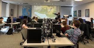
Satellite Image Interpretation for Geological and Environmental Studies
0
AA
By
Abubakar Abdinasir
In
Environmental & Natural Resources
Hi, Welcome back!
Keep me signed in
Forgot Password?
Sign In
Don't have an account?
Register Now